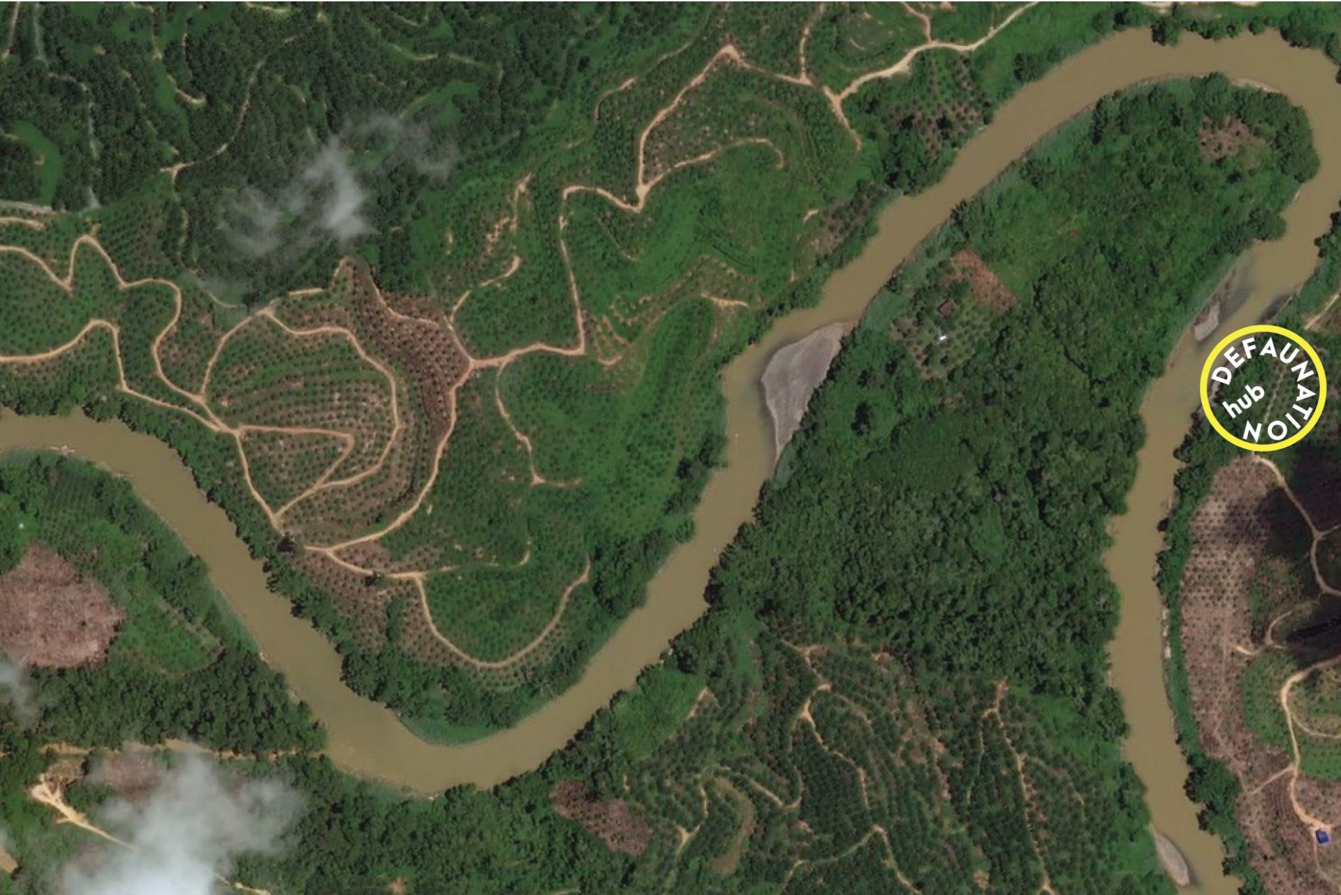
Wildlife declines as habitat is degraded, but also when habitat is lost in the wider landscape, even at otherwise intact forest sites. Therefore, we have generated deforestation and forest degradation information using satellite data and dynamic deforestation models.
One way we are doing this is to use annual forest maps derived from Landsat satellite imagery, which are freely available from the European Commission’s Joint Research Centre from 1990. Using temporal data in this way helps us reconstruct the history of forest cover change at any given site and timeframe to match to the biodiversity data. We can also make predictions of forest cover across the study region for years into the future.
Postdocs Maria Voigt and David Seaman developed these models island by island across the archipelago, with the first insights coming for the Sulawesi and Maluku archipelagos as part of the NERC-Ristekdikti Wallacea Programme. We now have a seamless coverage from Sumatra in the West through to Papua in East.
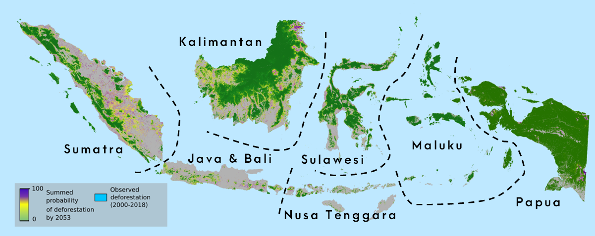
Deforestation risk across Indonesia based on 30 years of forest change data