Funding body: EPSRC Communities & Culture Network+ (2015-2016)
Principal Investigator: Prof. Marialena Nikolopoulou
Post-doc researcher: Dr Carolina Vasilikou
Partners: Canterbury Society
Summary
A sensescape map of a city area describes the common everyday qualities of walking and experiencing an open space, green, grey, public or private. While people navigate in the cityscape apparently based on their visual perception, the actual experience of wayfinding is multisensory. Sensory qualities may be attributed to uses of space, climatic conditions, people interaction and characterise uniquely a particular node, street or neighbourhood.
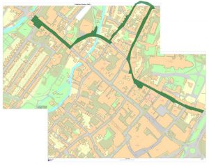
Using the UNESCO heritage sites of Canterbury city centre, and working along with Canterbury Society, a sensory mapping process is developed to record pedestrians’ sensory experiences in the cityscape, through a series of structured walks.
The collection of embodied experiences, creative atmospheres, paths and points of sensory interest in the traditional cityscape provides an educative vehicle of understanding the cultural heritage of the place and its everyday use.
The outcome of the project will be the creation of an interactive sensory map of navigation in Canterbury city centre, which will show the interaction of citizens and visitors with key places of the city, areas that call for intervention and development and spaces that need to be further promoted as cultural networks.